This project is still Under current Development
Vision

A map-based Reference and assistant tailored to Users!
Here is a visual of the UI and How the current version Works
The top Half of the screen is a Map that loads in a site of interest. The demo revolves around study abroad locations, and the map scene to the right depicts.
Below the map is a toolbar that has several buttons and features. At the moment, they are in testing phase, but will later include Map Intractable elements.
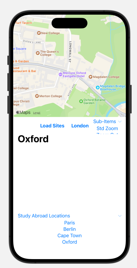
At the bottom of the screen, we display a list of Sites/cities that we want to display. When the user selects one of the options, the map will Autonomously transition to that location.
Key Features
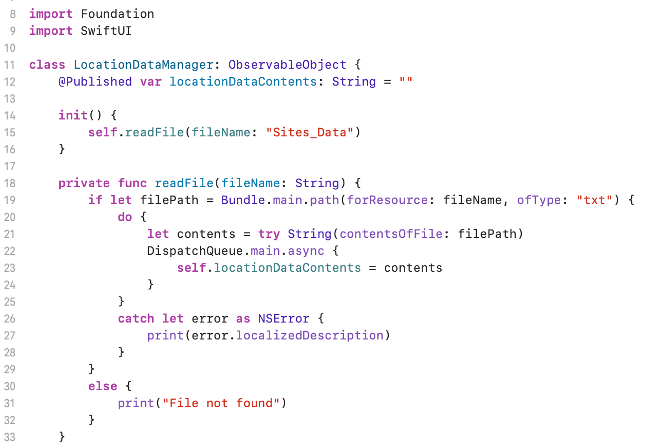
One of the key features of this app is that it will Persistently Update Site and Location-Specific data, and thus must load in data (eventually from a dataBase like Firebase) when the app loads. But even in this beta version, the app must load data before the content view appears. Here is a class that reads in data from a file and stores it when called in the content View body.
We store the object as an observed Object in the content view.

We can also load data from a pre-determined dictionary for key regions of interest. Here, the regions are mapped to specific coordinates Along with span values which will be passed to the MAp whenver the user seeks to change the map view to another location.
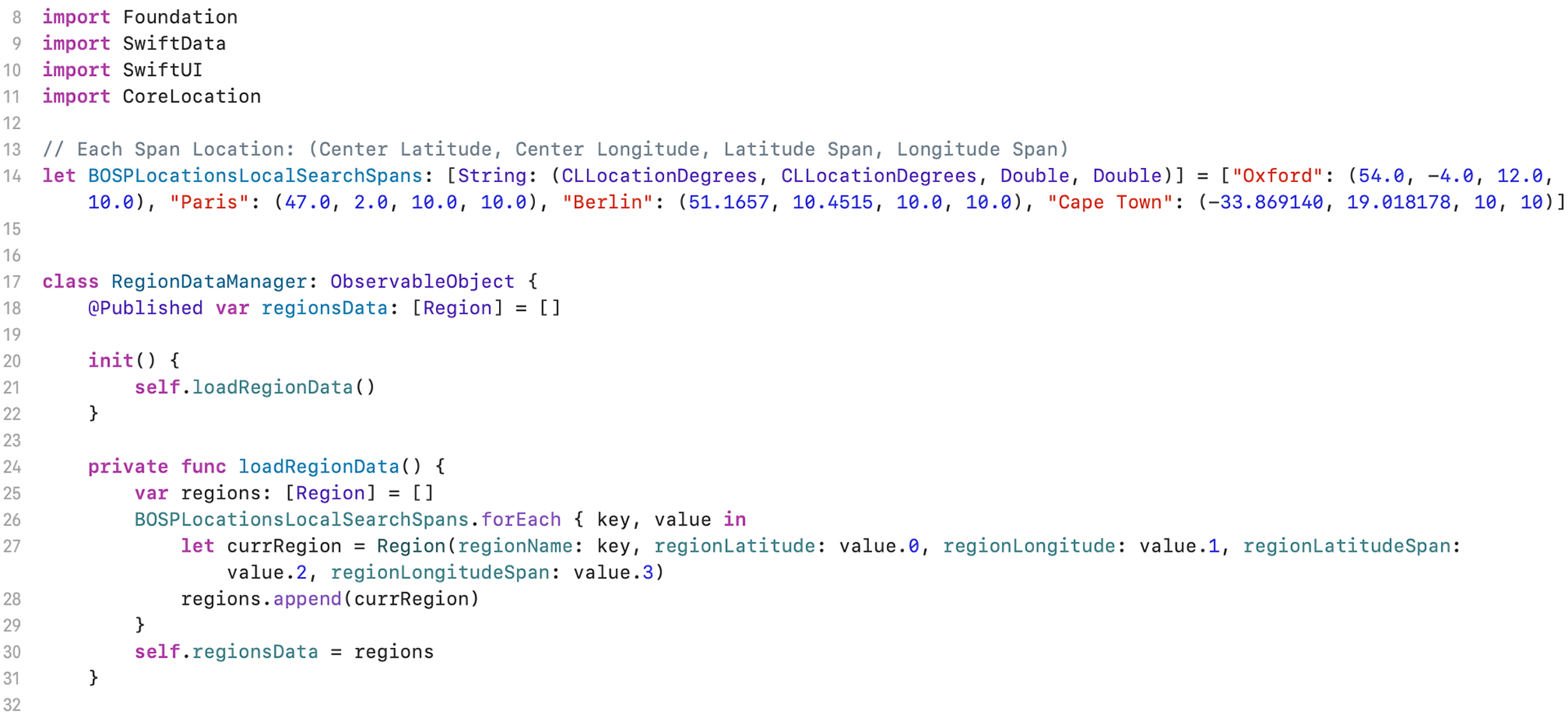
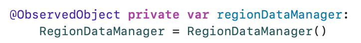
Similarly to the location Data Manager variable, we place load the region Data Manager as an observed object in the content view.
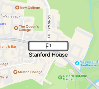
Now for a single site, it will appear on the map with an icon as shown on the left.
When you click on the map, a new UI View appears with images of the site as well as a brief description/overview.
In later iterations, users will be able to post comments, tips, or reviews for a site for others to see.

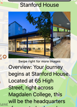
Users can scroll through the Images and even add their own.
A Navigation Split View provides Navigation Links to a "More Detail" section, which gives more detail on the sites in the current area. Here, you can see that in the "OXford" Region, we have 3 sites (will have more in future Iterations of the project): Magdalen College, Stanford House, and the Oxford Botanic Gardens.


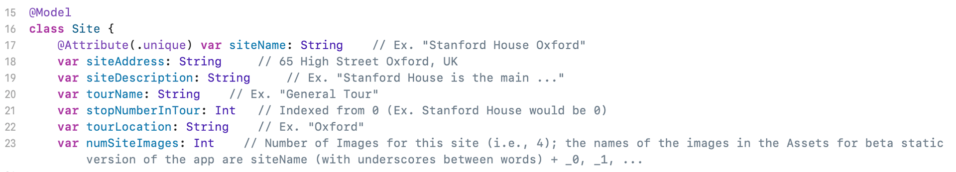
This is the class definition of a Site Object:
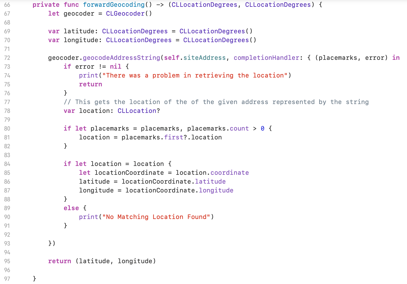
This function takes the address and outputs the latitude and Longitude Coordinates of that given address using Swift's Core Location library.
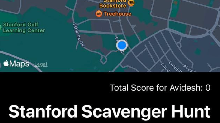
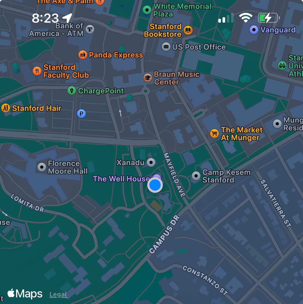
We are also able to display the Current Location of the User so that they are spatially aware of their location relative to other sites of interest on the Map:
Future Directions:
More accessibility of information about sites through Content View of UI.
Seamless transitions between the different regions on the Map through User Input (Button Clicks).
Walking Tours.
Ability to add comments and content on for sites.
Firebase Backend Data Stream.